Diagnosing dam seepage
21 March 2011Application of Willowstick technology can help pinpoint seepage through a complex geology. It is claimed that the unique application of electricity and the measurement of the resultant magnetic field can provide significantly better information than traditional methods. Paul Rollins explains how the technology was used to help focus remedial work at the Samanalawewa dam in Sri Lanka
Diagnosing seepage pathways in earthen embankment dams can be a tricky problem. In truth, there are not a lot of sure ways of characterising seepage and engineers often resort to installing monitoring wells. Such wells are targeted using professional judgment, which is based upon whatever knowledge can be gleamed from existing data and experience. Even more difficult are the decisions to be made regarding the remediation of seepage should it be determined to be a threat to the integrity of the structure that is under evaluation. Often, very costly capital projects are undertaken without a good handle on the underlying cause of the seepage problem. This often results in the investment of precious resources that do not ultimately fix the problem.
Today’s technology can provide significantly better information regarding the diagnosis of seepage related problems in earthen embankment structures. The following article will describe a relatively new geophysical technique that has proven successful over myriad seepage related issues in many different types of earthen embankment structures.
The Willowstick method
The Willowstick method is a proprietary geophysical process based primarily upon technology that has been named Controlled Source – Audio Frequency Domain – Magnetics (CS-AFD-M). The Willowstick method came to existence as a by-product of geophysical tinkering. The method is unique but resembles traditional geophysical methods such as magneto metric resistivity (MMR). In the early development stages, a similar version of this method was attempted to map ore bodies but the resultant ground-truth efforts revealed that groundwater was often the major and more prevalent conductor. As a result of this and other factors, the technology was later developed to target groundwater.
Physics behind the method
Based on Maxwell’s equations, an alternating electrical current in a conductor will generate an alternating magnetic field around the conductor. An alternating magnetic field will generate an alternating electrical current in a conductor that is under the influence of the alternating magnetic field. Willowstick creates a primary coil by building a large primary loop that consists of the antenna wire, electrodes, and the preferential conductive pathways (groundwater) in the subsurface between the electrodes. The secondary coils are in a magnetic receiver. When the magnetic receiver is under the influence of the magnetic field emanating from the primary coil (conductive subsurface flow path), the three receiver coils sense and measure the strength of the magnetic field emanating from the primary coil.
Conductive features will gather electrical current flowing in the ground. This is referred to as current gathering. Electric current flowing in the ground will follow long conductors or conductive zones that facilitate conduction between point A and point B (ie the two electrodes). One of the key ingredients for a successful survey using the Willowstick method is the placement of electrodes, for if electrodes cannot be located in the right areas or at the depths where seepage or groundwater is suspected, the technology will not provide the desired information.
Magnetic field measurements are collected at the surface with a magnetic receiver and are taken in a grid fashion with measurements located along lines and spaced at intervals of a few feet to tens of feet. These measurements collect the horizontal and vertical magnetic field magnitudes.
Equipment
The equipment used to measure the magnetic field includes:
• Three magnetic sensors oriented in orthogonal directions (X, Y and Z axes).
• A data logger used to collect, filter and process the sensor data.
• A GPS used to spatially define the field locations.
• A Windows based handheld computer used to couple the GPS data with the magnetic field data and store it for subsequent reduction and interpretation.
All of this equipment is attached to a surveyor’s pole and hand carried to each field station. The magnetic receiver filters and monitors various frequencies, amplifies the signals through noise-reduction algorithms, measures the strength of the signature magnetic field, and converts all the information to a recordable data set that is ready for subsequent processing and corrections.
Interpretation and modelling
After data reduction is complete, one or more Magnetic Field Contour (MFC) maps or ‘footprint’ maps are created to reveal the patterns of electrical current flow in the subsurface by showing contrast between areas of high and low electrical conductance.
In most cases electric current flow paths produce very tight and revealing anomalies that can be modelled with a high degree of accuracy (depths to within 10% error). Sometimes electric current flow patterns are not as distinctive and the depth and character can only be roughly estimated – in which case it is very important to have additional data to help select the groundwater zone of interest, such as, well logs, piezometric data, or other geophysical or hydrological data. In any case, the horizontal position of electric current flow paths is generally determined with a high degree of consistency and accuracy.
Potential applications
The Willowstick method has been applied to a myriad of different problems and there are still numerous other potential applications that have yet to be tried. Some of the better applications, learned from past experience are:
• 1. Mapping seepage in earthen embankment dams, canals and tunnels.
• 2. Mapping preferential flow paths in complex geology such as fractured rock and karst.
• 3. Finding leak pathways from evaporation ponds.
• 4. Mapping of preferential flow paths in heap leach piles.
• 5. Locating high producing targets for water resource wells.
• 6. Mapping leachate from landfills.
• 7. Mapping preferential flow paths in secondary oil recovery projects.
Most clients who use the technology do so to significantly increase their knowledge of site characteristics. Many clients are forced to deal with expensive monitoring campaigns and as a result need to place monitoring wells throughout a site. Quite often the information that they use to locate a well is not to their satisfaction, and the risk of installing a well that does not provide any value is high.
The Willowstick method can provide specific targets that often result in fewer wells because the success rate in intercepting flow paths is dramatically increased. Another great advantage comes from targeting remediation strategies. Often the use of the technology prior to grouting or groundwater treatment results in fewer dollars and man-hours spent.
Samanalawewa Dam, Sri Lanka
To better illustrate this point, a project case study clearly illustrates how the technology has successfully targeted remediation efforts.
As part of a much larger effort, Atkins Global, a UK based consulting firm, commissioned a Willowstick survey at Samanalawewa dam in Sri Lanka. The purpose of this survey was to assist Atkins in locating preferential flow paths trough probable karstic dissolution features in the underlying limestone rock. Atkins was to use this information to help target remedial works to stop existing seepage.
The construction of the Samanalawewa Dam commenced in 1986 and was completed in 1991. The dam is a zoned rockfill embankment with a clay core. The dam is roughly 105m high and 530m long and retains a reservoir with a capacity of 254Mm3. The catchment area of the dam covers 350km2.
The dam’s right abutment and right rim areas consist of karstic terrain. Karst conditions develop from the dissolution of the host rock along fractures, joints and/or bedding planes, which become enlarged over time from the saturation and flow of groundwater along these features. To combat this, the four adits for grout were constructed and driven along the axis of the dam.
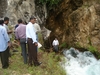
Despite the effort to cut off seepage through the right abutment area, a small spring appeared downstream of the dam upon initial filling of the reservoir in June 1991. The seepage was large enough to suspend filling the reservoir. As a remedial measure, a 1880m long tunnel was drilled beneath the right rim area and from inside the tunnel, a 100m deep by 1600m long grout curtain was constructed.
On the 22nd October 1992 water burst out of an area downstream of the right high pool. The water level was immediately lowered, however groundwater levels in the right abutment area were kept high as a result of a blockage at the downstream end of the karst/pipe feature. Once this blockage had been removed the groundwater level dropped by 2-3m in the abutment area. Nearly 25,000m3 of earth was washed away from the adjacent hillside.
Because of this seepage, a major project to dump large amounts of clay from barges began in an attempt to slow seepage from flowing out of the reservoir into suspected ingress areas along fault zones located in the right rim. However, after installing nearly 50,000m3 of clay, the leak was not stopped. No reduction was noted after the first phase dumping but after the second phase it was reported that the clay blanket did help reduce marginally the groundwater pressure in the right abutment.
Willowstick survey layout
The Willowstick investigation of the right abutment study area was undertaken to identify if major seepage path(s) exist through the previously installed grout curtain in the right abutment and if so, to determine what additional work should be performed to fully characterise seepage through or beneath the right rim grout curtain study area.
Willowstick performed two surveys with an injection electrode placed in the reservoir (some distance from the upstream face of the dam and right rim area). A return electrode was strategically placed in contact with seepage flowing from the hillside down gradient of the embankment.
The resultant data showed seepage through an open gap in the tunnel’s grout curtain and appears to be slightly below reservoir water level as well. Had the grout curtain been placed below the tunnel in the gap, seepage would still have passed through this area because the seepage flow is above the tunnel. Where the grout curtain was placed above the tunnel, just west of the adit’s grout curtain, seepage is split by the upward vertical grout curtain and some flows through the adit grout curtain, and some flows south of the tunnel around the adit‘s grout curtain.
The results of the investigation suggest that there are a series of braided seepage flow paths north and south of the tunnel that run beneath the right abutment study area. Seepage appears to concentrate around the right side of the dam rather than underneath or through the dam’s earthen embankment. There is some seepage occurring along the right rim grout curtain, but not to the extent that it is flowing through the right abutment study area.
Remedial works
The Willowstick survey confirmed two main areas where the cut-off is compromised. Having identified the location of what is believed to be the two largest sources of leakage through the right abutment area it is possible to undertake cost effective remedial works at Samanalawewa dam to ensure the safety and integrity and to bring the reservoir back to its proposed top water level and retain its ability to generate energy. These works will involve two measures, including:
• 1) Closing two significant gaps in the existing supplementary grout curtain.
• 2) Locating and filling major karstic features at an approximate elevation of 438mm.
This case study illustrates the value that the Willowstick method can provide. Had the technology been available to this client prior to undertaking the large and expensive remedial attempts, it is likely that millions of dollars would have been saved. Regardless of this, the technology certainly pinpointed seepage through a complex geology and allowed Atkins to focus remedial works.
The unique application of electricity and the measurement of the resultant magnetic field from electrical current flowing along conductive groundwater pathways can provide significantly better information than traditional methods, enabling engineers to improve the success rate of monitoring wells and remedial works.
Paul Rollins is the vice president for business development at Willowstick. Email: prollins@willowstick.com