A satellite remote sensing perspective on water resources
-
Figure 1. The various satellite missions in recent times that track the... -
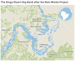
Figure 2. The Xingu river in the Brazilian state of Para and the Belo Monte... -
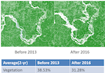
Figure 3. The trends in vegetation cover of the Xingu region as detected by... -
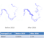
Figure 4. The trend in surface water cover as seen by Landsat satellite... -
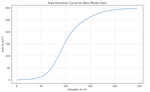
Figure 5. Area elevation curve (AEC) derived from satellite-based SRTM DEM... -
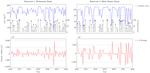
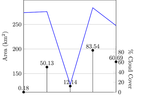
Figure 6. Time series of surface area change (upper panel) and storage change... -
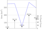
Figure 7. An example artefact created by potential local ground issues of... -

Figure 8. A mass balance approach to estimating how much water the dams of... -
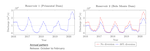
Figure 9. Reservoir outflow simulated by the mass balance approach using... -
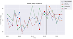
Figure 10. Satellite-derive surface water temperature patterns in the...

